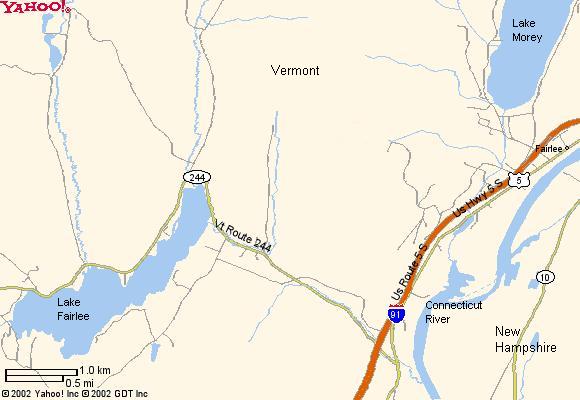
Lake Fairlee is about four miles west of Interstate 91 and the Connecticut River, just south of the village of Fairlee.
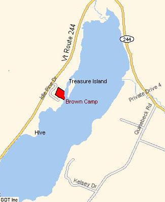 |
The property is about a half mile around the west side of the lake, just past a public beach called Treasure Island. (We are looking for a name for our camp. Suggestions appreciated) |
|
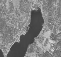
USGS makes available satellite imagery on the web, courtesy of NASA. Here is a recent picture of the north end of the lake. Click here to see the same image in a larger size. By comparing this image to the map above you can see the location of our property .
|
|
|
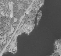
This is a blown-up view of the same photo. Click here to see it larger. Our lot is on the shore adjacent to the south end of the island visible in the photo.
|
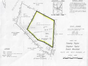
| Finally, here is a scan of the plot plan provided by the realator. Click here to see the full sized version. The lake is to the right; the road is visible at the top left. |
 |
- Link to photos of the land and cabins
- Link to main Vermont Contents Page
|